Shopping for a waterfront lot in Port Charlotte and wondering what “canal,” “corner,” or “harbor-facing” really mean for daily life and boating? You are not alone. The right lot affects your boat size, how fast you reach open water, what you can build, and what you will pay to maintain it. In this guide, you will learn the main lot types, how bridge clearance and depth affect access, what permits and insurance to expect, and how these factors shape value. Let’s dive in.
Waterfront lot types in Port Charlotte
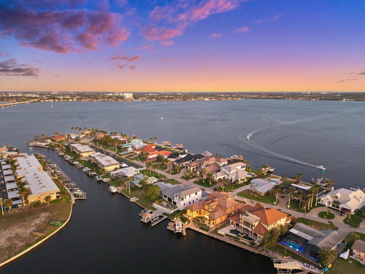
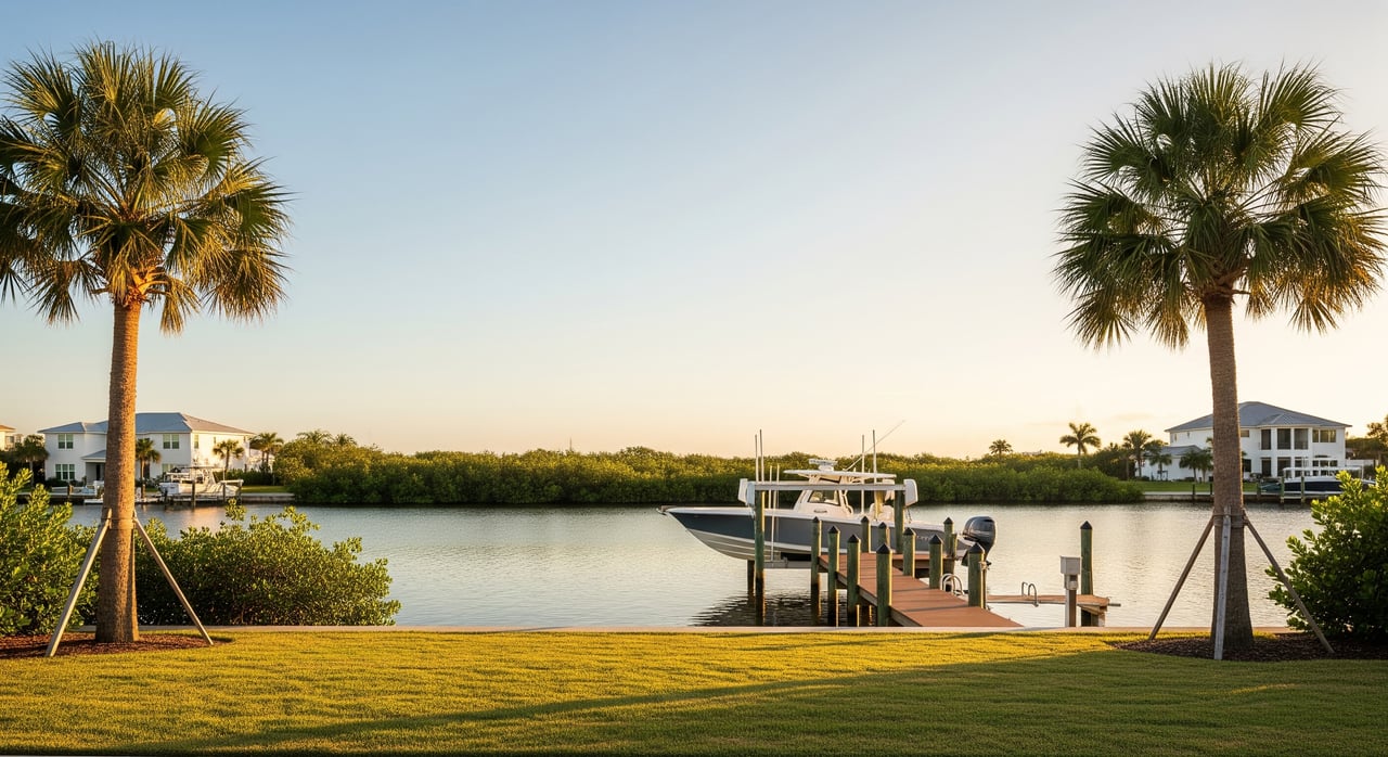
Canal-front lots
Canal-front lots sit on narrow, man-made canals behind residential streets. You can usually install a private dock with proper seawall and permits. Depth can vary, and turning space is tighter than on main channels. You get quiet water views that fit small to medium boats and easy backyard fishing.
Deep-water canal lots
These lots front wider, deeper canals that serve as primary neighborhood routes. You get better water depth, easier maneuvering, and more direct runs to Charlotte Harbor. If you have a larger powerboat or a boat with more draft, deep-water canals are often the better match.
Intersecting-canal and corner lots
At a T, L, bend, or canal intersection, these lots offer wider water frontage. The extra turning room makes docking larger or longer boats less stressful. You also tend to enjoy broader views and more light. Because of maneuvering ease and sightlines, these lots often trade at a premium.
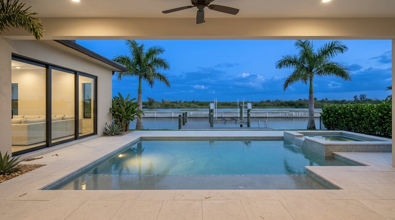
Harbor-facing lots
Harbor-facing properties open to Charlotte Harbor or other large water bodies. Expect more wind and tide exposure, deeper water, and faster access to intracoastal routes and the Gulf. You may need sturdier seawalls and docks, and construction elevations may be higher to meet code. The payoff is big-water views and direct boating.
River or inlet-facing lots
Some lots sit on natural rivers or creeks that connect to Charlotte Harbor. Currents can be stronger and tides more noticeable than on small canals. Boat access depends on channel depth and any bridges along the river. The setting can feel more natural and scenic.
Water-view lots without docking
A few parcels have a water view across preserved land or buffers but do not allow private docks. You get the visual appeal at a lower price and with less maintenance. Just confirm whether any access rights exist and what uses are allowed.
Boat access and bridge clearance
Know your route
Your boating freedom depends on the path from your dock to Charlotte Harbor. Count the bridges on your likely route and note whether they are fixed or movable. Fixed bridges with low vertical clearance can permanently limit your boat’s height. Movable bridges can open but may have set schedules.
Tides change clearance
Two clearances matter. Your boat’s air draft must clear bridges, and your boat’s draft must clear the channel bottom. Published bridge clearances are tied to a tidal datum, often near mean high water. A boat that slips under at low tide might not pass at high tide. Use authoritative charts and tide tools. You can review bridge locations and clearances on NOAA nautical charts and confirm tide behavior with NOAA tides and currents.
Depth and turning room
Canal depth can be shallower near the lot and shift with seasons. If you plan a lift or a longer vessel, intersecting-canal lots can make docking simpler due to added turning radius. Ask about the dredging history and maintenance responsibilities in your area.
Where to verify information
- Navigation charts and tides: NOAA nautical charts
- Notices and bridge operations: U.S. Coast Guard
- Local knowledge: marinas, boatyards, and towing services for real-world depth and bridge timing
Permits, codes, and insurance
Docks and seawalls
Docks, boat lifts, seawalls, riprap, and any dredging typically require permits at county, state, and sometimes federal levels. Shoreline work rules vary by waterbody and by the presence of wetlands or submerged vegetation. For environmental and shoreline permitting requirements, review the Florida Department of Environmental Protection. Always check the condition of any existing seawall and factor repair or replacement into your budget.
Flood zones and building codes
FEMA flood maps determine your flood zone, insurance triggers, and required finished-floor elevation for new builds. Start with the FEMA Flood Map Service Center. Florida Building Code and local rules prescribe wind resistance, elevation, and foundation types. Coastal high-risk areas often have stricter standards.
Utilities and HOAs
Confirm whether public sewer and water are available or if the area uses septic. For docks and lifts, plan for shore power and buried utility runs. If an HOA is involved, review rules on dock size, boat lifts, seawall appearance, and architectural guidelines.
Taxes and assessments
Waterfront parcels can carry higher property taxes and, in some neighborhoods, special assessments for dredging or seawall maintenance. Check parcel records and community documents before you write an offer.
How lot type affects value
Waterfront generally commands a premium over non-waterfront, but the amount depends on water type, usable depth, and route to open water. Lots with deeper water, fewer low-clearance bridges, and shorter runs to Charlotte Harbor are often the most sought after by active boaters. Intersecting-canal and harbor-facing lots can earn higher prices due to broader views and better maneuverability. On the flip side, any maintenance liabilities, like aging seawalls or silted canals, can reduce value or lead to credits during negotiation. If a lot is labeled “waterfront” but does not allow a private dock, its value is different for buyers who need on-site boat storage.
Due diligence checklist
Use this checklist to validate your top picks before you buy or build:
- Confirm the exact water type and the route to Charlotte Harbor and the Gulf; map out every bridge on the path.
- Verify published bridge clearances and consider tide ranges; match them to your boat’s air draft.
- Ask for canal depth at the lot and at the end of a proposed dock; request recent soundings from a marine contractor.
- Inspect the seawall with a licensed marine contractor or civil engineer and estimate remaining life.
- Check permitting history for any existing dock, lift, seawall, or dredging; confirm as-built conditions.
- Pull FEMA flood zone and Base Flood Elevation; get preliminary flood insurance quotes.
- Confirm public water and sewer availability, plus any easements and right-of-ways on the lot.
- Order a geotechnical report for custom builds to determine foundation needs and corrosion risks.
- Review HOA or deed restrictions on docks, boat lifts, setbacks, home height, and style.
- Screen for environmental limits like mangroves, seagrass, or wetlands that may restrict work.
- Check title for riparian rights, access easements, and any recorded limits on the shoreline.
- Compare recent sales for truly similar waterfront types and conditions.
Questions to ask the seller
- Who maintains canals and pays for dredging or seawall repairs, and is there a history of assessments?
- What is the maintained channel depth from the property to Charlotte Harbor?
- Are there known bridge restrictions on the most direct route to open water?
- Which permits exist for the dock, lift, or seawall, and are as-built plans available?
- Is the property in an HOA or maintenance district, and what fees apply?
Your next steps
Choosing the right Port Charlotte waterfront lot is about aligning your lifestyle with real-world access, build rules, and long-term costs. Focus on bridge clearance, canal depth, and seawall condition. Confirm flood and code requirements early so your design, dock, and lift work together. Then compare true comps by waterfront type so you pay the right price.
If you want a confident, concierge-style path from lot selection to closing, connect with a trusted local advisor. Reach out to Sebastian Bokemeier to discuss your goals and next steps.
FAQs
What is the difference between canal and harbor lots in Port Charlotte?
- Canal lots are on man-made canals with variable depth and tighter turns, while harbor-facing lots open to Charlotte Harbor with deeper water, broader views, and faster open-water access.
How do bridge clearances impact boat choice and routes?
- Fixed low bridges limit a boat’s air draft, while movable bridges can open on schedules; always compare your boat’s height to published clearances and factor in tides.
What permits are needed for docks and seawalls?
- Docks, lifts, seawalls, and dredging typically need county, state, and sometimes federal permits; start with the Florida Department of Environmental Protection for shoreline rules.
How do flood zones affect building and insurance?
- FEMA flood zones set elevation and insurance requirements; use the FEMA Flood Map Service Center to identify your zone and Base Flood Elevation.
Why do intersecting-canal corner lots cost more?
- They often provide more water frontage, better views, and easier boat maneuvering, which many buyers value for larger boats and a stronger “on the water” experience.
Where can I verify bridge and depth information?
- Check NOAA nautical charts for charted depths and bridge data, and review U.S. Coast Guard notices for operational updates.