Shopping for a waterfront home in Cape Coral and seeing the phrase “Gulf access” everywhere? If you plan to boat, fish, or island-hop on weekends, understanding what that term really means can make or break your purchase. You want confidence that your boat fits the route, that the trip to open water suits your lifestyle, and that you are not surprised by hidden limits or costs. In this guide, you will learn the types of access, what to verify about bridges and depths, and a practical checklist to use before you short-list homes. Let’s dive in.
Gulf access in Cape Coral: the big picture
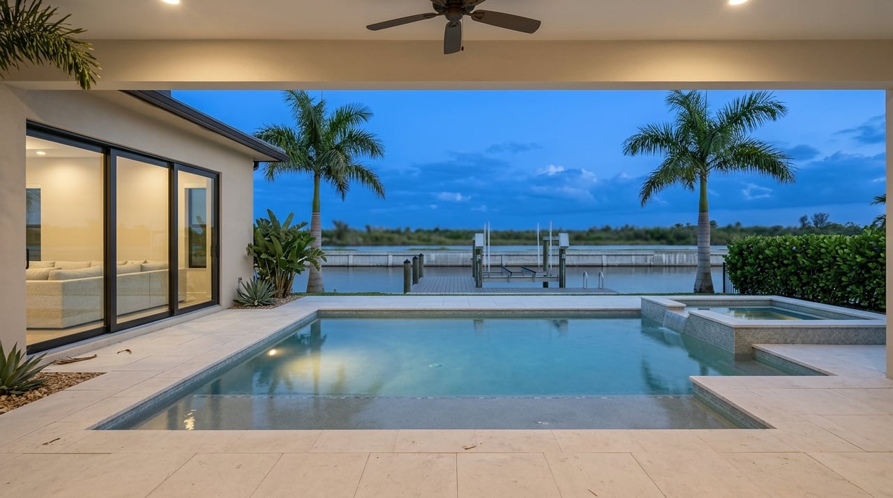
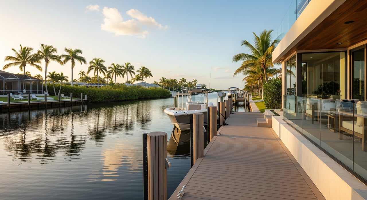
Cape Coral is a canal city on Florida’s southwest coast with hundreds of miles of navigable waterways. Many residential canals connect to larger waterways that lead to the Caloosahatchee River, San Carlos Bay, Pine Island Sound, and then the Gulf of Mexico. That sounds straightforward, but not all “Gulf access” is equal. Routes vary in bridge height, depth, channel width, and travel time, so you need to match the property to your boat and your plans.
What listing terms really mean
Direct Gulf access
Listings often call this “no bridges” or “open Gulf access.” The implied meaning is a short and fairly unobstructed route to open water without passing under fixed bridges that would block tall superstructures or masts. In Cape Coral, “direct” suggests a quick path through the canal network into the river or bays, then out to the Gulf. The term is not standardized, so verify the exact route.
Indirect Gulf access
You will also see “indirect,” “via river,” or “through bridges.” The route connects to the Gulf but includes fixed bridges with limited vertical clearance, drawbridges with opening schedules, narrow channels, or longer travel times. Many powerboats do well with indirect access, but taller flybridges and most sailboats may not fit. Ask for the bridge clearances and how long the trip takes at normal cruising speeds.
Freshwater canals
Some listings say “freshwater access” or “freshwater canal.” This usually means the canal or lake does not provide practical saltwater navigation to the Gulf, or the connection is blocked or too remote for boating plans. In Cape Coral, some freshwater systems are completely inland. Others may eventually tie into tidal systems. Confirm whether there is any meaningful route to saltwater if Gulf boating is one of your goals.
Three checks to confirm before you buy
Bridge clearance
Know the tallest fixed point on your boat and compare it to every bridge on your route. Fixed bridges have a posted vertical clearance, while drawbridges operate on schedules that affect timing. Confirm whether stated clearances are measured at mean high water. If your boat has a radar arch, tower, or mast, the numbers matter.
Depths and tides
Depths change with tides, seasons, and shoaling. You want the controlling depth at low tide for the tightest part of your route, not just an average. Ask for depth information, any recent sonar surveys, and whether the canal or approach is maintained or dredged. Low tide may be the limiting factor for deeper draft boats.
Channel width and turning room
Residential canals can be narrow, with tight bends and shallow edges. Beam and maneuverability become real-world constraints for larger boats. If you plan to keep a wide or long vessel, ask a local boater or marine contractor to run the route and note pinch points. Turning room at your dock also matters.
Boat types and typical fit
These general ranges can help you frame the conversation. Always verify your exact boat’s specifications and compare them to route data before you commit.
- Small runabouts, bay boats, small center consoles: 16 to 24 ft. Draft often 6 to 18 in. Usually the most flexible for shallow canals.
- Mid-size center consoles, dual consoles, cuddy cabins: 20 to 30 ft. Draft often about 18 to 30 in. Common for nearshore fishing and day trips.
- Express cruisers and larger pilothouse boats: 30 to 40 plus ft. Draft around 3 to 4 ft, varies by model. May be limited by shallow canals and some bridges.
- Yachts and larger vessels: 40 plus ft. Draft often 4 to 6 plus ft. Height and beam become major constraints.
- Sailboats: Mast height is often the deciding factor. Many need much higher vertical clearance than fixed bridges allow.
Lifestyle tradeoffs and price realities
Direct Gulf access
If you boat often, fish offshore, or plan weekend island trips, direct access is hard to beat. You spend less time transiting and more time on the water. These properties typically carry a premium relative to inland or freshwater waterfront options. Insurance exposure, maintenance, and dock sizing are important to budget.
Indirect Gulf access
This can be a great fit if you run a low-profile powerboat or do not mind a bridge opening or a longer ride. Many buyers find the pricing more attractive than direct access in similar areas. Factor in drawbridge timing, fuel runs, and your typical use pattern when you compare homes.
Freshwater or canal-only lots
If your priority is a peaceful water view, kayaking, paddleboarding, or a small low-draft boat, freshwater lots can deliver. They often sell at lower premiums than true Gulf-access waterfront. Consider your long-term plans, since upgrading to a larger boat later could be difficult.
Costs and risks to budget
- Dock, lift, and seawall: Condition and capacity matter. Replacement or upgrades can be a significant expense, especially on older seawalls or undersized lifts.
- Insurance: Coastal properties often require flood insurance. Marine insurance for your boat is separate and depends on exposure, boat type, and docking.
- Dredging and shoaling: Some residential canals are not maintained. If your canal shoals and homeowners are responsible, costs can arise.
- Resale: Buyers who need open-water access can be a narrower pool, especially for sailboats and large yachts. A clearly documented route and confirmed bridge and depth data help future resale.
Your verification checklist
Use this list to organize requests and independent checks before you make an offer.
Ask the listing side for
- A route map from the dock to open Gulf waters, including all bridges and channel markers.
- Vertical clearance data for every bridge on the route, noted at mean high water if available.
- Tide information and the controlling depth for the shallowest channel segment, plus any recent sonar or dredging history.
- Whether the route includes maintained channels or only residential canals.
- Dock and lift permits, piling spacing, lift capacity and age, and any code issues.
- Seawall inspection reports or repair permits and history.
- HOA or municipal rules that affect boat size, lifts, or guest docking.
- Evidence of no encroachments or underwater obstructions.
Independently verify
- NOAA nautical charts and local tide and current tables for approach channels and depth context.
- U.S. Coast Guard or state transportation sources for official bridge clearances and drawbridge operations.
- A professional survey, a local marine contractor, or a test run of the route at different tides. Request a sonar check of the slip if your draft is deeper.
- Your boat’s tallest fixed point and draft against posted clearances and low-tide depths.
- FEMA flood zone, elevation requirements, and any available elevation certificate for the lot.
- Insights from local boaters, marinas, or shipyards about shoaling or bridge issues.
Keep these documents on file
- Permits and as-built surveys for seawall, dock, and lift.
- Recent inspection reports and maintenance invoices.
- Photos or video of the route at low tide and of tight turns or pinch points.
How a local advisor helps
The right advisor saves you time by organizing technical checks and aligning the property with your boating plans. A local expert can coordinate route confirmations, connect you with marine surveyors and contractors, gather permits and inspection records, and help you budget for upgrades. If you are buying a seasonal home or an investment, you can also plan for property management and vacation rental operations from day one. When you are ready, connect with Sebastian Bokemeier to map your route to the Gulf and secure a waterfront home that truly fits your lifestyle.
FAQs
What does “Gulf access” mean for Cape Coral homes?
- It means the property’s waterway connects to the Gulf of Mexico, but the route can range from quick and unobstructed to longer trips with bridge and depth limits.
How do I know if my boat will clear Cape Coral bridges?
- Measure your boat’s tallest fixed point, then verify the posted vertical clearance for every bridge on your route, ideally at mean high water.
What is the difference between direct and indirect Gulf access?
- Direct typically implies no low fixed bridges and a shorter route, while indirect includes bridges, schedules, or narrower channels that add time or limit taller boats.
Are freshwater canal homes in Cape Coral good for boating?
- They are great for kayaks, paddleboards, and low-draft boats, but most do not offer practical routes to the Gulf; confirm the connection before you buy.
What extra costs should I expect with Gulf-access properties?
- Budget for dock, lift, and seawall work, higher coastal insurance, and possible dredging if canals shoal and maintenance is not provided.
How can an agent help verify a Cape Coral route to the Gulf?
- A local advisor can assemble bridge and depth data, arrange a professional route check, collect permits and inspections, and align the home with your boat and goals.